Google Earth AI and the New Deepfake Problem
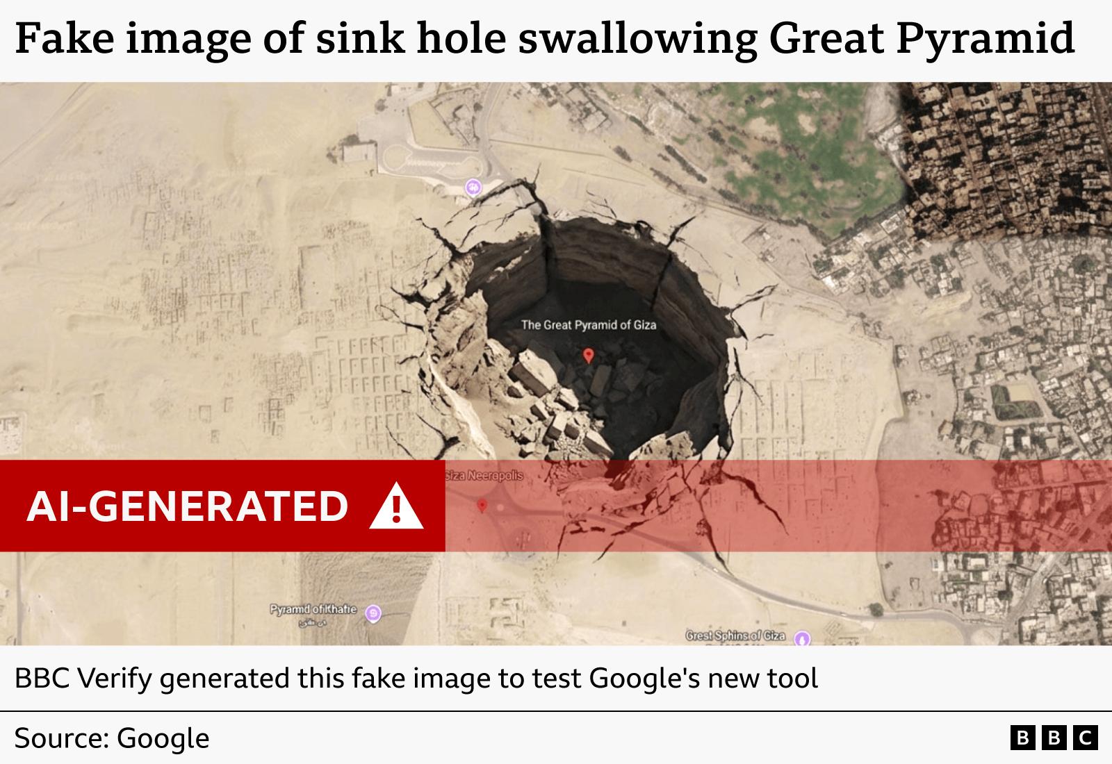
Google Earth AI is pushing mapping and geospatial work into a faster, more automated phase, and that sounds useful until you think about what happens when synthetic images meet real places. A tool that can generate or enhance Earth-related visuals can help with flood planning, disaster response, and land analysis. It can also blur the line between a real satellite view and a fabricated one. That matters now because trust in visual evidence is already shaky. If a fake image of a wildfire, border crossing, or flooded neighborhood looks convincing enough, who checks it before it spreads? The problem is not the model alone. It is the speed, the scale, and the way people treat maps as fact.
What Google Earth AI changes
- It speeds up analysis. Teams can scan large areas faster than with manual review.
- It can automate visual work. That helps with pattern finding, change detection, and location-based decisions.
- It raises verification risk. Synthetic or altered imagery can look close enough to real data to fool casual users.
- It affects trust in maps. People often assume geospatial images are neutral. They are not.
Google has spent years turning Earth imagery into a practical tool for planners, researchers, and businesses. Earth Engine and related AI systems help sort through satellite data that would be painful to inspect by hand. That is the upside. The downside is plain. The more capable the system gets, the easier it becomes to create location-based content that looks authoritative without being authentic.
Maps feel objective because they are visual. That is exactly why deepfake-style manipulation in geospatial tools is dangerous.
Why Google Earth AI deepfake risk is different
Most people think of deepfakes as faces, voices, or video clips. Geospatial fakes are quieter and, in some cases, more dangerous. They do not need celebrity faces or dramatic lip sync. They just need a believable patch of land, a street grid, a storm track, or a burned field.
That makes the threat feel a bit like changing one ingredient in a recipe and serving it as the original dish. The plate looks right. The result is wrong.
And the consequences can be real. Emergency planners may rely on imagery to route crews. Journalists may use satellite visuals to confirm events. Investors may look at site activity. If the image has been generated, edited, or context-stripped, the decision built on it can go sideways fast.
How you can judge a geospatial image faster
You do not need to become a satellite analyst to spot trouble. You do need a simple process. Start with the source. Then check the date, the platform, and whether the image lines up with other records.
- Check the origin. Ask where the image came from and who published it first.
- Look for time stamps. A stale image can be misleading even if it is real.
- Compare with other sources. Search for the same location in another mapping service or news report.
- Watch for impossible details. Shadows, weather, road layouts, and building shapes should match the place and time.
- Use the metadata when available. EXIF data, capture dates, and platform labels can help, though they are not foolproof.
One image should never carry the whole argument. If the claim matters, you need a second source. Maybe a third.
What businesses should do now
Companies using Google Earth AI or similar geospatial tools should set rules before the pressure hits. That means requiring source labels, logging edits, and keeping a review step for any image used in reports, presentations, or public statements.
Do not let a model-generated view pass as evidence without a human check. That is not caution theater. It is basic hygiene.
Where policy and product design need to catch up
The real fix is not only user education. Platforms need provenance markers, clear labels, and tamper-resistant records that follow the image from creation to publication. Content credentials and watermarking can help, but they are only part of the answer. If the label is easy to strip or ignore, it will fail under pressure.
Google, like other major AI vendors, has to think beyond what the model can generate. It has to think about what people will believe. That is the harder job. Anyone can build a system that outputs a convincing scene. The non-negotiable part is making sure the scene cannot silently pass for evidence.
Look at it like architecture. A building is only as safe as the inspection process behind it. The same applies here. You can have a powerful mapping model and still end up with a brittle trust system.
What to watch next with Google Earth AI
The next test is whether Google adds stronger disclosure, provenance, and verification tools around Earth AI outputs. If it does, the product can stay useful without turning into a trust problem. If it does not, users will have to do more of the checking themselves.
That is the fork in the road. Do you want faster maps, or do you want maps you can defend?