Mississippi Winter Weather: Wet El Niño Signal Meets Strong Polar Vortex
Your winter plans in Mississippi now come with a tricky forecast setup. Mississippi winter weather is being shaped by two big atmospheric signals, a strengthening polar vortex and a growing El Niño pattern, according to the Clarion Ledger report. That mix can affect rainfall, cold snaps, severe weather risk, and the odds of any wintry mess reaching the state. It does not mean a locked-in forecast for snow or ice. It does mean you should plan for a wetter season, watch late-season cold shots, and avoid treating one climate signal as the whole story.
What Stands Out Right Now
- A stronger polar vortex can keep the coldest Arctic air bottled up farther north, at least for stretches.
- El Niño often tilts the Gulf South toward wetter winter conditions, especially from late fall into winter.
- Mississippi can still get sharp cold fronts, even in a milder overall pattern.
- Rain and saturated ground may matter more than snow for many homes, farms, and roads.
- Small changes in storm track can decide whether a winter system brings cold rain, sleet, or ice.
What Mississippi Winter Weather Signals Mean Now
The Clarion Ledger points to a winter setup where the polar vortex strengthens while El Niño grows. In plain English, one signal may reduce frequent Arctic outbreaks, while the other may feed more storm systems across the southern United States.
That combination can feel messy because it is not a single forecast. It is more like watching two coaches call plays from opposite sidelines, with Mississippi stuck at midfield. You may get mild weeks, then a hard front that makes everyone dig for pipe covers.
Winter forecasts are probability maps, not promises. Treat them as planning tools, then update your plans as shorter-range forecasts sharpen.
That is the part many seasonal outlooks fail to explain. A warmer-than-average forecast does not block a three-day freeze, and a wetter-than-average forecast does not mean it rains every weekend.
How El Niño Can Shape Mississippi Winter Weather
El Niño develops when warmer-than-average water spreads across the central and eastern equatorial Pacific. NOAA’s Climate Prediction Center tracks that pattern because it can shift the jet stream and push more active storm tracks across the southern tier of the United States.
For Mississippi, the practical signal is often more rain. South Mississippi, the Pine Belt, the Gulf Coast, and parts of central Mississippi can see repeated systems that make yards soggy and rural roads sloppy. Farmers and construction crews know this drill well.
Does El Niño guarantee a cold, wet winter? No, and that is the trap. It raises the odds of wetter conditions, but local outcomes still depend on Gulf moisture, storm timing, soil temperatures, and how much cold air is in place when a system arrives.
Why rain may be the main story
Rain has a boring reputation until it piles up. If storm systems repeat every few days, drainage ditches, low spots, and poor road shoulders can turn into the biggest day-to-day problem.
Homeowners should check gutters, downspouts, crawl spaces, and sump pumps before the first long wet stretch. If you live near a creek or a flood-prone road, bookmark National Weather Service alerts now rather than scrambling during a downpour.
Where the Polar Vortex Fits Into Mississippi Winter Weather
The polar vortex is a ring of strong winds high above the Arctic. When it stays strong and compact, bitter air often remains closer to the pole. When it weakens or gets disrupted, cold air can spill south into the United States.
A stronger vortex can reduce the number of deep Arctic intrusions into Mississippi. But it does not build a wall. Fronts can still sweep through, and a short-lived pattern shift can bring freezing temperatures to Jackson, Tupelo, Greenville, Meridian, Hattiesburg, and the Coast.
That combination matters.
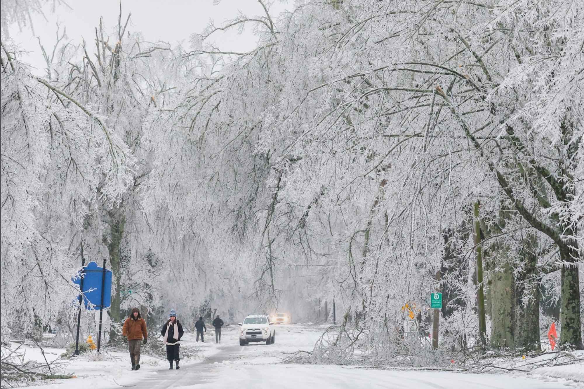
The harder question is timing. If a Gulf system arrives while shallow cold air sits near the ground, Mississippi can get sleet or freezing rain even without a classic snow setup. Ice is often the bigger hazard here because a thin glaze can wreck bridges, trees, and power lines.
What This Means for Temperatures, Rain, and Ice Risk
Seasonal outlooks usually speak in averages. Your life does not. A winter can finish warmer than normal and still include one costly freeze that damages pipes, citrus trees, livestock water lines, or early blooms.
Look, this is where hype gets people into trouble. A headline about the polar vortex can make it sound like doom is parked over your roof, while an El Niño headline can make winter sound simple. Neither view is solid.
- For temperatures: Expect swings. Mild spells may dominate, but late-night freezes can still show up fast.
- For rainfall: Plan for more active storm periods, especially if the southern jet stream stays energized.
- For severe weather: Winter thunderstorms are possible in Mississippi, particularly when warm Gulf air returns ahead of a front.
- For wintry precipitation: The risk is usually lower than rain, but it depends on storm timing and surface temperatures.
Think of the forecast like cooking gumbo. The ingredients matter, but the timing and heat decide the final dish. El Niño adds moisture to the pot, while the polar vortex affects how much cold air gets stirred in.
How to Prepare for Mississippi Winter Weather Without Overreacting
You do not need to panic-buy half a hardware aisle. You do need a short checklist that fits Mississippi’s real winter hazards, which are heavy rain, brief freezes, icy bridges, power outages, and occasional severe storms.
Start with your house. Wrap exposed pipes, clear gutters, test space heaters, and confirm that carbon monoxide detectors work. If you use a generator, keep it outside and far from windows (yes, even during cold rain).
- Keep three days of food, water, medicine, and pet supplies ready.
- Store flashlights, batteries, and a charged power bank in one place.
- Know which roads near you flood first.
- Protect outdoor faucets before the first freeze warning, not after it starts.
- Follow local National Weather Service offices for short-range updates.
Drivers should pay special attention to bridges and elevated ramps. Mississippi ice events are often patchy, which makes them sneaky. A road can look fine until the shaded bridge deck turns slick.
Why Seasonal Forecasts Can Miss Your County
Seasonal forecasts cover broad regions, not your backyard. NOAA, private weather firms, and local meteorologists can flag trends, but county-level winter impacts often depend on events that form a week or less before they hit.
This is especially true across Mississippi because the state sits near several winter boundaries. North Mississippi can flirt with colder air while the Coast stays warm and stormy. Central counties can land in the transition zone, where rain changes character fast.
The smartest move is to treat long-range outlooks as your first draft. Then, inside seven days, shift your attention to forecast discussions, watches, warnings, and hourly temperature trends.
The Practical Read for the Months Ahead
The best read on Mississippi winter weather is cautious, wet, and changeable. El Niño supports a rainier setup, while a strong polar vortex may limit frequent deep cold. Still, one disruption can change the feel of winter for a week.
My advice after years of watching seasonal forecasts get flattened into bad headlines is simple: prepare for rain first, protect against freezes second, and keep an eye on any system that arrives with cold air already in place. The next smart step is not guessing snowfall totals. It is checking your drainage, your pipes, and your local forecast before the first real winter system shows up.